Don Harris//October 9, 2013
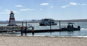
Buster Johnson is living proof — literally — that U.S. Highway 93, which provides Phoenix area residents with direct access to Las Vegas, is one of Arizona’s most dangerous roads.
Frequent users of U.S. 93 will tell you that the trip has become less stressful with the construction of 155 miles of four-lane stretches between Wickenburg and the Nevada state line, seven passing lane segments, and the Mike O’Callaghan-Pat Tillman Memorial Bridge over the Colorado River that bypasses Hoover Dam.
That leaves approximately 49 miles of two-lane pavement. It is those two-lane segments just north of Wickenburg that give motorists fits.
Johnson, a Mohave County supervisor, has bone-chilling memories of an incident some 10 years ago that convinced him to avoid U.S. 93 if at all possible. “I was almost killed,” he says. “I was driving from Kingman to a meeting in Wikieup. It was two-lanes then. A semi was coming from the opposite direction, when a couple of good old boys in a pickup decided to pass him. They couldn’t get around the semi. I stayed in my lane. The semi went by on my left and they went on the dirt on my right. I didn’t want to make a move — let them make the move.”
After Johnson’s blood pressure returned to somewhat normal, he called the people he was supposed to see in Wikieup. “I told them, ‘I’m going home. There will be no meeting tonight.’”
Annual reports from the Arizona Department of Transportation, which continues to upgrade U.S. 93, do not provide fatality statistics on specific highways. A review of news reports turned up these U.S. 93 fatalities:
April 2012: A semi-truck and an SUV collided about 10 miles north of Wickenburg, killing both drivers. Investigators said the southbound SUV drifted into the path of the truck.
September 2011: A semi-truck rolled over after colliding with a pickup truck about 16 miles north of Wickenburg, killing the driver of the pickup. In an unrelated incident almost an hour later in the same area, a tank in a semi carrying 13,000 pounds of ammonium was punctured, spilling the chemical onto the highway. Both incidents were about 4 miles from where a Department of Public Safety helicopter pilot and two bikers were killed in a head-on collision a week earlier.
May 2011: One person was killed and two others were injured in a head-on collision about 20 miles north of Wickenburg. A car crossed the center line and crashed head-on into a tractor-trailer, killing the driver of the car. A third vehicle plowed into the wreckage, injuring two people.
January 2009: Three men died and five people were injured in a two vehicle accident near Wikieup.
One of the most serious accidents occurred on a four-lane stretch of U.S. 93 near Dolan Springs. In February 2009, a tour bus headed back to Las Vegas from the Grand Canyon crashed, killing seven passengers and injuring 10 more.
In 2012, ABC15 Investigators conducted an in-depth review of ADOT data and found that from 2009 to 2011, 48 people were killed in crashes on U.S. 93, making it one of the most deadly in Arizona. That compared with 72 deaths on Interstate 17 from Phoenix to Flagstaff; 81 on Interstate 10 from Phoenix to Tucson; and 85 on Interstate 10 from Phoenix to California.
ADOT’s annual reports list fatal crashes on rural roads, which would include U.S. 93, but don’t break down the statistics by specific highways. They do show, however, that safety upgrades appear to be saving lives.
For example, in 2008 there were 451 fatal crashes on rural highways resulting in 523 deaths. In 2012, the number of fatal crashes on those highways decreased to 360, a drop of 91, while the number of deaths was 424 — or 99 fewer than in 2008.
ADOT doesn’t agree that U.S. 93 is one of Arizona’s most hazardous highways. In fact, Dustin Krugel, ADOT public information officer, says no location of U.S. 93 is currently listed in the top five crash locations in the state.
And Bart Graves, media relations manager for the Arizona Department of Public Safety, says, “Highways don’t kill people, driver error kills people. Motorists need to slow down and pay attention. We’ve never investigated a highway killing a person in a vehicle.”
ADOT’s long-term vision is to transform this highly-traveled route into a four-lane, divided highway through the entire 200-mile stretch from Wickenburg to the Nevada state line, Krugel says. “Much of U.S. 93 has been upgraded from a rural two-lane roadway built in the 1950s into a modern four-lane divided highway to improve travel between Phoenix and Las Vegas,” he says. “ADOT recognizes the importance of this corridor, which links Phoenix to northwestern Arizona and beyond. The corridor is part of the National Highway System and has been designated as a potential part of the proposed Interstate 11 corridor.”
Since the 1990s, ADOT has dedicated nearly $400 million to widening and improving U.S. 93. Based on a 1992 study of the 109 miles of the heavily traveled road from Wickenburg to I-40, long-range improvements were divided into three segments:
Santa Maria River to Wikieup (mile posts 124.5 to 160.5) — The study recommended improving this segment first because it is the most rugged mountainous stretch of highway and posed the most challenges to drivers. The widening improvements were completed in February 2008 at a cost of $174.7 million.
Wikieup to I-40 (mile posts 91.5 to 124.5) — This segment was selected as the second priority because it has many curves and elevation changes, but it is not as mountainous as the segment between Santa Maria River and Wikieup. Several segments were completed between 2005 and 2012. The current 5-year program has funding to construct one more segment (Antelope Wash) and design is underway on the Carrow to Stephens section. The design of the final segment (Cane Springs) is programmed for fiscal year 2016. Total cost thus far of $76 million.
Wickenburg to the Santa Maria River (mile posts 160.5 — 193.5) — This segment is the last priority because it is the flattest, straightest segment of the highway. The first section of this roadway that will be upgraded to a four-lane highway is a five-mile segment between state routes 71 and 89, which is designated to go to bid next year.
In the meantime, ADOT has installed a series of centerline rumble strips along the two-lane stretch of U.S. 93 between state routes 71 and 89, alerting drivers if they veer out of their lane. ADOT has also added signs in areas that haven’t been widened, reminding drivers of two-way traffic. The daytime use of headlights is recommended in some sections as well.
Although not directly affected by U.S. 93 traffic, the intersection of state routes 71 and 89 at Congress, just northeast of U.S. 93, poses a safety problem of its own.
Rowle Simmons, a Yavapai County supervisor and former three-term Prescott mayor, says he hardly ever uses U.S. 93 and knows it has a reputation for being dangerous, but is deeply concerned about the point where 89 and 71 intersect. “I was told by the fire department in Congress that the intersection is one of the top 15 in the state for accidents. There’s a stop sign there, but they could really use (traffic) lights.”
Krugel emphasizes that the remaining projects to improve U.S. 93 to a four-lane divided highway will depend on statewide priorities and available funding. The State Transportation Board recently reduced funding for the 5-year plan by $350 million, impacting ADOT’s ability to commit additional funds to the corridor, Krugel says.
The remaining U.S. 93 projects and tentative construction targets include:
1. Antelope Wash, milepost 101.8 to 104 (2013).
2. Carrow Stephens, milepost 116.3 to 119.7, (2016).
3. Cane Springs, milepost 106 to 108.9.
4. Wickenburg Interim Bypass and SR 89, milepost 193 to 198.
5. The segment between Wickenburg and the Santa Maria River will be the last to be improved.
Johnson of Mohave County says he is disappointed by the Transportation Board’s decision to eliminate the widening project of the Carrow Stephens section north of Wikieup from the 5-year plan. Commenting on the overall landscape along U.S. 93, Johnson says, “There’s nothing out there, not even a house, and people go pedal to the metal. The designs are good, but drivers get out of control because they’re going so fast. It’s pretty dangerous.’’
Other than backups that occur when passing becomes chancy on the stretches with fewer than four lanes, the only recurring bottleneck is west of Kingman where the off-ramp from I-40 meets Beale Street, which is the continuation of U.S. 93.
ADOT hosted a public meeting on Sept. 26 for the I-40 and U.S. 93 interchange study. ADOT and the Federal Highway Administration, in coordination with the Bureau of Land Management, initiated a study in 2011 to evaluate alternatives that will improve traffic flow in that area. The initial design concept report, including recommended alignments, and a draft environmental study were unveiled. The current estimate for the project is $86 million.
Johnson says there is no timeline for final design approval, construction and completion, but he says the project is needed and should be cost effective.
Krugel says the most effective way to enhance safety “is to upgrade the two-lane sections to a four-lane divided highway and that’s why ADOT has continued to invest in upgrading this corridor with a goal of creating a modern, four-lane highway from Phoenix to the Hoover Dam.”
Graves of DPS agrees. “Improvements with four-lanes and passing lanes always help,” he says. “The major causes of accidents are driver fatigue, speeding and driver inattention/distraction.”
He says there are roughly an equal number of crashes on U.S. 93 for northbound and southbound traffic.
Indeed, passing lanes improve traffic flow and enhance safety, and Krugel says capacity and safety remain as important issues as traffic volumes continue to increase.
Some of the four-lane sections of U.S. 93 likely would be included in a proposed Interstate 11, though the route has yet to be determined. “To bring U.S. 93 up to interstate standards,” Krugel says, “there would be additional projects, including new interchanges that would be required.”
A key piece of the I-11 puzzle undoubtedly would be the $114 million O’Callaghan-Tillman Memorial Bridge some 900 feet above the Colorado River. The bridge eliminated by far the worst bottleneck on the Phoenix to Las Vegas run — driving on a winding road leading to Hoover Dam and then crossing the dam where tourists congregate. Arizona’s contribution was no small feat. Total cost of the overall project was $240 million and was within budget.
The widening from two lanes to four of the 15 miles of roadway from milepost 2 to 17 just south of Hoover Dam was completed in November 2010 at a cost of $71.3 million. The projects included a new trailhead, scenic overlooks and three wildlife crossings. It gives motorists a continuous four-lane divided highway between Kingman and the bridge.
The widening project required more than 3.5 million cubic yards of excavation, more than 2.9 million pounds of reinforced steel for the bridges and various concrete segments, and included more than 22 miles of new guardrail and 4.5 miles of culvert pipe.
Johnson of Mohave County says, “Overall, the 93 corridor operates well, and will continue to do so for the next five to ten years with the planned improvements. The widening between I-40 and Wikieup has largely addressed traffic flow needs in that area, but we need to see completion of the entire 200 miles.”
Completed projects
U.S. 93 north of Interstate 40
Kingman to Hoover Dam (milepost 2 to 17)
In November 2010, ADOT completed construction on the final 15 miles of roadway south of the Hoover Dam, providing motorists with a continuous four-lane divided highway on Interstate 40 between Kingman and the new Hoover Dam Bridge.
Project construction included widening an existing 15-mile roadway section, and providing significant highway improvements. The $71.3 million lane widening project includes a new trailhead at milepost 4.1, and a new scenic overlook at milepost 13.5. The existing overlook (milepost 12.7) has also been upgraded. Three wildlife crossings over U.S. 93 were constructed at mileposts 3.3, 5.2, and 12.2 to protect motorists and provide a safe crossing for the Desert Bighorn Sheep, native to the Black Mountains.
U.S. 93 south of Interstate 40
The first segment on south U.S. 93, spanning 36 miles between Wikieup and Santa Maria was completed in February 2008. This section of the highway was divided into nine different projects. It included widening the highway to four lanes and building two bridges one at Burro Creek and the other at the Santa Maria River.
Southbound Wagon Bow Ranch and Southbound Deluge Wash
Construction to widen and improve a seven-mile segment of US 93 north of Wikieup (milepost 109 to 116.3) was completed in July 2012. The $26 million project provides motorists with new southbound lanes and another completed section of four-lane divided highway.
Wikieup to Interstate 40
ADOT has completed four widening projects between Wikieup and I-40. Construction on the southbound Ranch Road project, located 17 miles north of Wikieup (milepost 104 to 106), was completed in late 2009. The $5.8 million lane widening project, funded by the American Recovery and Reinvestment Act, provides two additional miles of four-lane divided highway.
McGarry’s Wash
Construction on U.S. 93 at McGarry’s Wash, located just south of the I-40/U.S. 93 traffic interchange (milepost 91.7 to 95.2), was completed in October 2008. The $9.8 million project consisted of constructing a parallel roadway to create a four-lane divided highway.
Old U.S. 93 to Antelope Wash
The $20 million four lane widening project from old U.S. 93 to Antelope Wash (milepost 91.4 to 101.9) was completed in January 2007.
Tompkins Canyon
Construction north of Wikieup near Tompkins Canyon (mile post 119.5 to 121.2) consisted of parallel roadway to create a four-lane divided highway. The $10.6 million project was completed in November 2008.
U.S. 93 Wickenburg Bypass
In February 2010, ADOT completed the Wickenburg Interim Bypass which has relieved the congestion at the intersection of U.S. 93 and U.S. 60 in downtown Wickenburg. The $30 million project included constructing a four-lane divided highway, two roundabouts and a new bridge.
— Source: Arizona Department of Transportation
By the Numbers
• U.S. 93, Wickenburg to Nevada state line: approximately 200 miles
• U.S. 93, Wickenburg to I-40: 109 miles
• 4-lanes: 155 miles
• 2-lanes: 49 miles
• Passing-lane segments: 7
• Improvement cost since mid-1990s: $400 million.
— Source: Arizona Department of Transportation